
Editing networks#
Editing an AequilibraE network is editing any other node and link layer in QGIS. Before doing so, however, take a look at the discussion of the network triggers behind the AequilibraE network, particularly the section on network consistency behavior.
Snapping to node#
When editing a transportation network, especially an AequilibraE network, snap-to-vertex prevents the user from creating nodes that are infinitesimally close, yet disjoint. When loading layers from the QAequilibraE panel, vertex snapping is turned on against every AequilibraE layer loaded in your QGIS project, so link endpoints land exactly on the existing nodes. Layers that do not belong to the model, such as basemaps, are left out, so you do not snap to them by accident.
Your own snapping configuration is saved when the first AequilibraE layer starts being edited and restored once the last one leaves edit mode, so nothing changes outside of an editing session.
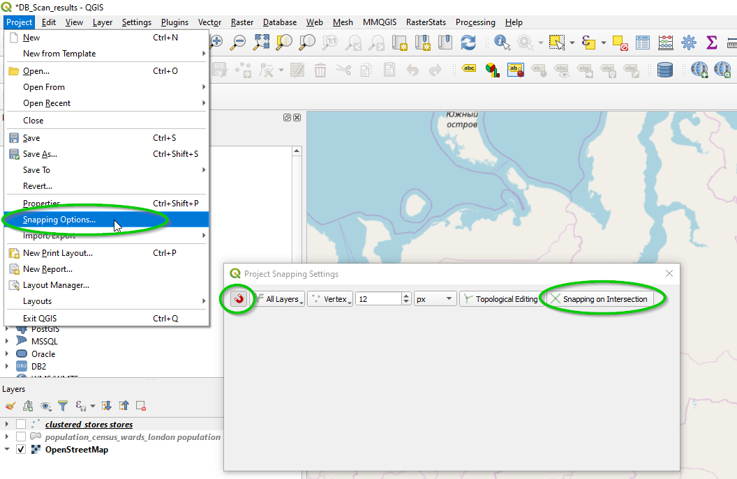
The snapping tolerance - how close you have to get to an existing vertex before the cursor snaps to it - is the one already configured for the QGIS project, which you can change under Project > Snapping Options
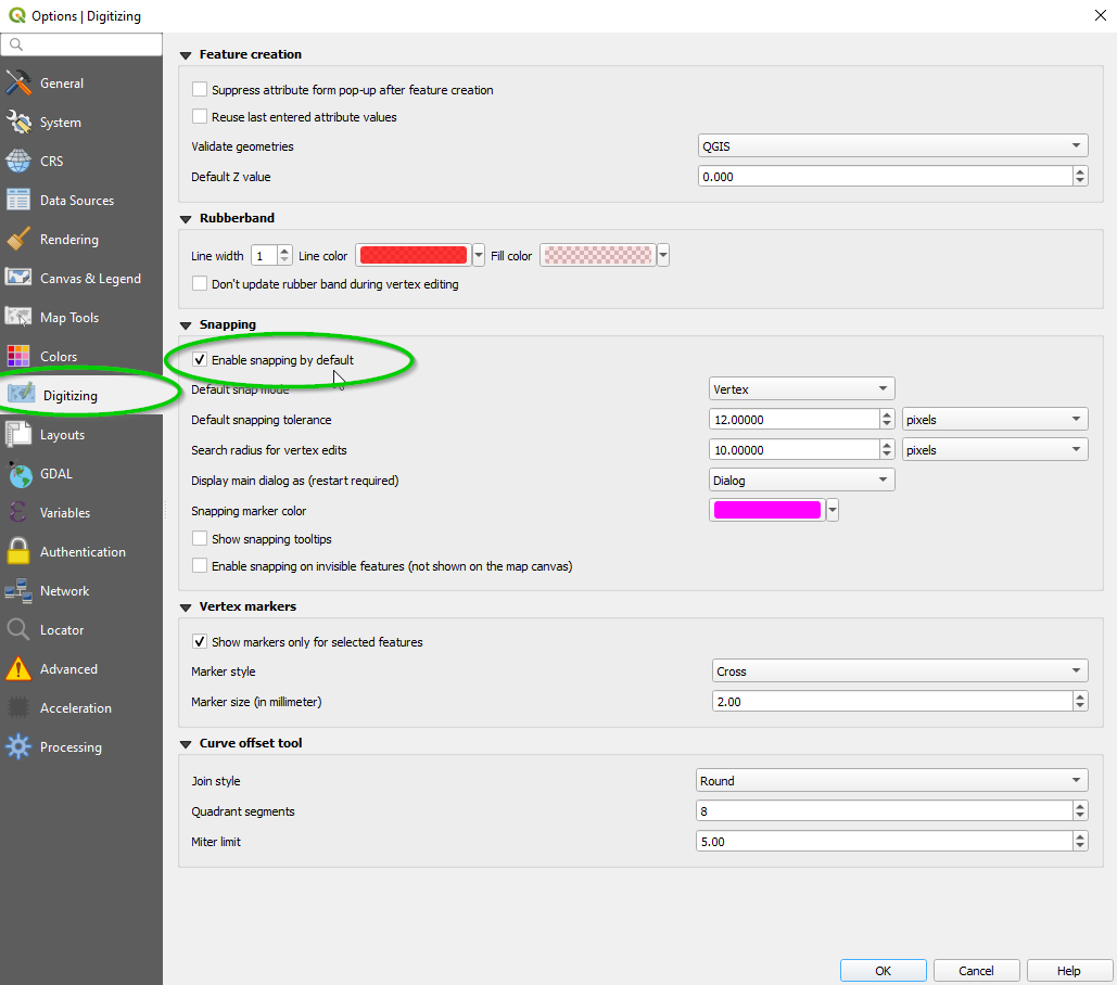
To change the tolerance used by default in all future projects, one can access the menu Settings > Options and select the Digitizing menu from the side options, as shown below
You can still override any of it from the QGIS snapping toolbar while editing, just keep in mind that toggling another AequilibraE layer for edit re-applies the defaults described above.
For more resources, you can just make a quick online search or even go directly to a one of many existing tutorials.
Digitizing links#
The attribute form of the links layer is configured when the layer is loaded from the QAequilibraE panel, so a new link only asks for what the model cannot work out on its own.
link_id and ogc_fid are filled with the next values available.
a_node and b_node are hidden. The database works both out from the endpoints of the link as soon as it is saved, so there is nothing there to fill in.
modes and link_type are drop-downs built from the modes and link_types tables of your project, so a value the model does not know about cannot be typed in by accident. link_type starts on default and cannot be left empty, since a link without a link type is refused by the database.
Both drop-downs then offer whatever you chose last, which saves picking them again for every link of a run. QGIS remembers those for as long as the layer stays loaded, so the first link after reopening the project starts from the defaults above.
Nodes created while digitizing are numbered from 10,000 up, leaving the lower numbers free for you to assign to centroids. Nodes that already exist are never renumbered, and a model already numbering past 10,000 simply carries on from where it was.
Digitizing zones#
A new zone comes with its zone_id and ogc_fid already filled in, each following the largest currently in use, so a model numbering its zones by hand carries on from where it left off. Both remain editable, since a zone numbering that follows the study area rather than the order zones were drawn in is entirely normal.
Breaking links at nodes#
A link drawn across nodes it snapped to along the way is saved as one link per stretch between them, so the network is connected at each of those nodes rather than having a single link running over the top of them. The attributes you entered are copied to every stretch, and each one gets its own link id.
Only nodes that already exist break the link, which is why it pays to snap. Crossing another link where no node exists is a topology problem this cannot see: the crossed link is never touched, and neither is anything else already in the model.
The behavior can be turned off under Options > Break links at nodes while digitizing in the QAequilibraE panel, and the choice is remembered across QGIS sessions. See the Options menu.
Topological Editing#
From the QGIS manual:
The option Enable topological editing is for editing and maintainingcommon boundaries in features mosaics. QGIS ‘detects’ shared boundary bythe features, so you only have to move a common vertex/segment once,and QGIS will take care of updating the neighboring features.
So if you are editing zoning layers, I highly recommend you go to the QGIS manual and read about it!
GIS tricks#
There are some basic tools in QGIS that might come in handy when you are working with AequilibraE, so we have described a few of them here.
Multipart Vs. Singlepart geometries#
In GIS, geometries can be SinglePart or MultiPart, where the first is what one would consider a regular geometry, while the latter is not always intuitive.
Examples of MultiPart geometries are countries that contain islands, so a geometry of the country should be formed of disjoint areas, or streets that are interrupted by the existence of a park. These elements, however, do not have place in traditional transport modeling, and we present a procedure to eliminate the occurrence below.
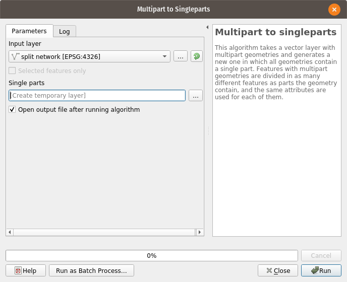
One can transform all MultiPart features into SinglePart ones using a QGIS standard tool, which can be accessed on Vector > Geometry Tools > Multipart to Singleparts.
Running it looks like this:
Just notice that, after this process to a network, you will HAVE to run through all the steps described in preparing a network.
Centroids from area layers#
In order to add centroids to a network, one must first curate a layer of centroids and number them appropriately, as discussed in adding centroids.
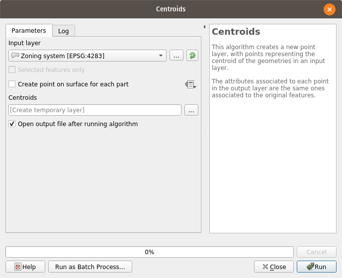
QGIS has straightforward tools to extract centroids from areas, which can be accessed through the menu Vector > Geometry Tools > Centroids, as shown below
One should always remember to visually inspect the results of the automatic process, in this case looking for those centroids that were placed in awkward places and move them to more appropriate positions.
One might need to convert the zoning system to a SingleParts layer before following the instructions above, which can be done following the description provided in multipart to singlepart.